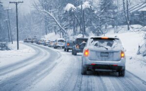
Snow Day Predictor Canada

AI-powered · Multi-model forecast · 2026–27 season

Snow Day Predictor CanadaWill school be cancelled tomorrow?

AI-powered closure engine cross-checks the Canadian Meteorological Centre's GEM model against two independent weather sources, then applies per-province school board tolerance — from coastal BC to Iqaluit.

Quick check:

Multi-model forecast, five-factor closure engine, province-aware results. No sign-up, no tracking of your queries.

13
Provinces covered
14
Regional profiles
5
Closure factors
0
API keys required
Advertisement

Snow day forecasts across Canada

Will school be cancelled in your Canadian city tomorrow?

The Snow Day Predictor Canada works for every postal code in the country — from downtown Toronto and the GTA boards (TDSB, Peel, York, Halton, Durham) to coastal British Columbia districts in Vancouver and Surrey, Quebec service centres in Montreal and Laval, Calgary and Edmonton in Alberta, the Prairie cities of Winnipeg, Saskatoon and Regina, the Atlantic provinces, and right up to Whitehorse, Yellowknife and Iqaluit.

Whether you’re a parent, a teacher, a student, or a school bus driver, our forecast engine weighs the same overnight weather conditions Canadian school boards evaluate before they make the morning call: snowfall accumulation, blowing snow and visibility, freezing rain, wind chill, and active Environment and Climate Change Canada warnings. Two probabilities are returned — school closure and bus cancellation — because in the Canadian system those are separate decisions.

The algorithm

How the predictor decides

School boards make the call between 5 am and 6:30 am based on the overnight weather window. We model that exact decision in three steps.

  1. 1

    Pull tonight’s overnight forecast

    We pull live hourly weather data for the 8 pm to 8 am window at your exact coordinates — snowfall, wind gusts, freezing rain, wind chill, visibility, and weather warnings — from multiple forecast models in parallel.

  2. 2

    Compare to your region’s closure patterns

    We compare those conditions to the documented closure behaviour of Canadian school boards in your region. Coastal BC, the Prairies, and the GTA all behave very differently in the same storm.

  3. 3

    Return two clear probabilities

    You get a school-closure probability, a bus-cancellation probability (Canadian buses cancel more readily than buildings close), a confidence label, and the underlying weather conditions for your city.

What boards actually look at

  • Overnight snowfall accumulation — the dominant signal in every Canadian region.
  • Blowing snow and visibility — high gusts plus loose snow shut down rural bus routes even when accumulation is modest.
  • Freezing rain and ice pellets — disproportionately disruptive; 2 mm of freezing rain is a stronger signal than 10 cm of dry snow.
  • Extreme cold — Prairie and Northern Ontario boards close below −40 to −45 °C wind chill.
  • Official warnings — Blizzard, Winter Storm, Snowfall, Freezing Rain, and Extreme Cold warnings from Environment Canada.

Why province matters

A 15 cm storm in Vancouver shuts the city down. The same storm in Edmonton is a normal Tuesday. Our forecast reflects how your region actually behaves rather than averaging across Canada.

  • Coastal BC: closes earliest in Canada — even 5–10 cm shuts Vancouver and Victoria.
  • Rural / Northern Ontario: long bus routes make boards more cautious than the GTA.
  • Quebec: service centres tolerate snow but cancel quickly for freezing rain.
  • Alberta and the Prairies: highest tolerance in Canada — 25 cm is a normal Tuesday.

What we monitor

Live winter weather conditions across Canada

Our forecast draws on the same overnight weather signals school boards evaluate before they make the morning call.

Snowfall
Overnight accumulation

Hourly snowfall totals between 8 pm and 8 am — the single strongest predictor of a school closure across Canada. Lake-effect bands, Alberta clippers, and Colorado lows all show up as overnight accumulation in this window.

Wind
Gusts and blowing snow

Gusts combined with snow on the ground create whiteout conditions on rural bus routes — even when total accumulation is modest. Rural Ontario, the Prairies, and Atlantic Canada are particularly exposed to blowing-snow closures.

Ice
Freezing rain and ice pellets

Just 2 mm of freezing rain creates an ice glaze that closes more schools than 10 cm of dry snow. Quebec service centres along the St. Lawrence and Atlantic boards see the most freezing-rain events.

Cold
Overnight wind chill

Prairie boards (Winnipeg SD, Saskatoon Public, Regina Public) and Northern Ontario districts close when wind chill drops past safety thresholds — typically −40 to −45 °C, and as low as −50 °C in the territories.

Warnings
Environment Canada alerts

Blizzard, Winter Storm, Snowfall, Freezing Rain, Wind, and Extreme Cold warnings issued by Environment and Climate Change Canada all corroborate closure risk. Blizzard Warnings carry the most weight.

Region
Local closure history

Coastal BC closes at 8 cm. Alberta routinely operates through 25 cm. Quebec service centres tolerate snow but cancel quickly for ice. Our forecast reflects how your region’s school boards actually behave, not a single national average.

How tomorrow’s snow day forecast is built

We pull the overnight forecast window — 8 pm tonight to 8 am tomorrow — for your postal code or city from multiple weather models in parallel, including the Canadian Meteorological Centre’s GEM model. We then look at the same signals Canadian school boards weigh: how much snow is falling, whether winds will blow it around, whether freezing rain or ice pellets are in the mix, the overnight wind-chill minimum, and any active Environment Canada warnings. Each Canadian region has its own snow-tolerance pattern based on documented school board behaviour. You get a school-closure probability, a bus-cancellation probability, and a confidence label — without needing to read a single weather model yourself.

By region

Typical Canadian school board closure patterns

Closure thresholds vary dramatically across Canada. These are common patterns documented by school boards in each region — your local board may close for less or more.

RegionSnow threshold
Coastal British Columbia8 cm overnight
Interior British Columbia18 cm overnight
Alberta25 cm overnight
Saskatchewan25 cm overnight
Manitoba25 cm overnight
Greater Toronto Area15 cm overnight
Rural and Northern Ontario12 cm overnight
Quebec20 cm overnight
New Brunswick20 cm overnight
Nova Scotia20 cm overnight
Prince Edward Island18 cm overnight
Newfoundland and Labrador25 cm overnight
Yukon30 cm overnight
Northwest Territories30 cm overnight
Nunavut30 cm overnight

Source: documented school board closure policies and historical bus cancellation patterns across the named regions. Figures rounded to round numbers; individual boards may differ.

The definition

What is a snow day in Canada?

A snow day is a day when Canadian schools cancel classes — or transportation consortia cancel buses — because of winter weather conditions. The criteria vary wildly across our 10 provinces and 3 territories.

School closure decisions in Canada are made between 5:30 and 6:30 am by school board superintendents, transportation directors, or district leadership teams, based on overnight weather observations and the morning forecast. A 15 cm snowfall that closes Vancouver and Surrey schools is a normal operating day in Calgary or Edmonton. A wind chill of −40 °C that’s routine in Winnipeg would shut down every district on coastal British Columbia. That’s why our forecast applies a Canada-aware regional layer to every prediction.

Canadian snow day decisions consider:

  • Overnight snowfall accumulation between 8 pm and 8 am — the most direct closure signal across every Canadian region.
  • Blowing snow and reduced visibility on rural bus routes — even a few centimetres of new snow can become a whiteout in 60 km/h gusts.
  • Freezing rain and ice pellets — 2 mm of freezing rain creates a glaze that closes more schools than 10 cm of dry snow.
  • Extreme cold with wind chill values past regional safety thresholds — typically −40 °C in southern Canada, −45 to −50 °C in the Prairies and North.
  • Active winter weather warnings from Environment and Climate Change Canada — Blizzard, Winter Storm, Snowfall, Freezing Rain, and Extreme Cold warnings.
  • The type of weather system — lake-effect snow squalls off Georgian Bay and Lake Ontario, Alberta clippers, Colorado lows, and Atlantic nor’easters each behave differently and trigger different board responses.

In the Canadian system, bus cancellations and full school closures are separate decisions. The Toronto District School Board, for example, rarely closes buildings — students who can get themselves to school still come in — but its student transportation consortium cancels buses several times each winter. Our predictor returns probabilities for both outcomes.

The decision process

How Canadian school boards decide to cancel school

From overnight monitoring to the 6 am announcement — here’s the documented chain Canadian boards follow.

  1. 1

    Overnight monitoring (3–5 am)

    Transportation directors and board operations staff check Environment Canada warnings, Canadian Meteorological Centre forecasts (GEM, HRDPS), and regional snow accumulation reports. Some boards subscribe to private weather consultancies for additional input.

  2. 2

    Bus route assessment (4–5:30 am)

    Student transportation consortia evaluate whether bus routes are safe. STSCO (Central Ontario), STSWR (Waterloo Region), HSTS (Halton), and Toronto Student Transportation Group all coordinate across multiple boards. Rural routes with long distances and limited plowing are usually cancelled first.

  3. 3

    Board-level decision (5:30–6:30 am)

    Superintendents confirm whether buildings open with normal service, open with cancelled bus service, or close entirely. In Quebec, service centres like CSSDM, EMSB, and Lester B. Pearson coordinate separately. In Atlantic Canada, HRCE and the Anglophone districts often align across the region.

  4. 4

    Public communication (5:30–7 am)

    Announcements push to board websites, parent apps, social media, local radio, and television. In Ontario, BusPlanner notifications are widespread. In Quebec, apps like Mon CSS push to parents. Halifax Regional Centre for Education and Vancouver SD #39 broadcast via their own apps.

Boards rarely close pre-emptively the night before — even confirmed major storms typically wait for the morning forecast to stabilize. Our predictor targets the same 8 pm–8 am overnight window the boards actually evaluate.

Coverage

Snow day predictor by Canadian city

The predictor works for every Canadian postal code. Here are the cities our forecast most often serves, with notable local weather patterns and major school boards.

Toronto, Ontario
TDSB · TCDSB · Toronto Student Transportation Group

GTA bus cancellations are far more common than full school closures.

Mississauga & Brampton, Ontario
Peel DSB · DPCDSB · STOPR

Peel and Dufferin-Peel Catholic close together; STOPR cancels buses first.

York Region, Ontario
YRDSB · YCDSB

Markham, Vaughan, Aurora, Newmarket, Richmond Hill — heavy snow squall corridor.

Ottawa, Ontario
OCDSB · OCSB · OSTA

Eastern Ontario lake-effect from Lac-Beauchamp and the Ottawa Valley.

Hamilton, Ontario
HWDSB · HWCDSB

Lake Ontario lake-effect snow common in January and February.

London, Ontario
TVDSB · LDCSB

Southwestern Ontario snow belt; squalls off Lake Huron and Lake Erie.

Sudbury & Thunder Bay, Ontario
Rainbow DSB · Lakehead DSB

Northern Ontario; cold-driven closures more than snow alone.

Montreal, Quebec
CSSDM · EMSB · Lester B. Pearson SB

St. Lawrence freezing-rain corridor; service centres coordinate by region.

Laval, Quebec
CSS de Laval · Sir Wilfrid Laurier SB

Anglophone and Francophone networks make calls independently.

Quebec City, Quebec
CSS de la Capitale · CSS des Découvreurs

Heavier nor’easter snowfall than Montreal; CSS network announcements via apps.

Vancouver, British Columbia
Vancouver SD #39 · Burnaby SD #41 · Richmond SD #38

Coastal closures begin at 8 cm; salt and plowing infrastructure is minimal.

Surrey, British Columbia
Surrey SD #36 · Delta SD #37

Largest district in BC; closes on the same criteria as Vancouver.

Victoria, British Columbia
Greater Victoria SD #61 · Sooke SD #62 · Saanich SD #63

Lower closure threshold than Vancouver — even 5 cm can shut buses.

Kelowna & Kamloops, British Columbia
Central Okanagan SD #23 · Kamloops-Thompson SD #73

Interior BC; mirrors Prairie tolerance with high snowfall and cold thresholds.

Calgary, Alberta
CBE · Calgary Catholic SD · Rocky View Schools

Highest snow tolerance in Canada; chinook recovery days are common.

Edmonton, Alberta
EPSB · Edmonton Catholic SD

Routinely operates through −35 °C wind chill; closures driven by blizzards.

Winnipeg, Manitoba
Winnipeg SD · Pembina Trails SD · Louis Riel SD

Wind chill is the primary driver; outdoor recess cancels before classes do.

Saskatoon & Regina, Saskatchewan
Saskatoon Public · Regina Public · Sun West SD

Buses cancel often; full school closures are reserved for blizzards.

Halifax, Nova Scotia
HRCE · Annapolis Valley · South Shore

Atlantic nor’easters; HRCE announces via its mobile app the night before for major storms.

Saint John & Moncton, New Brunswick
Anglophone South · Anglophone East · Francophone Sud

Bay of Fundy storms and freezing-rain events.

Charlottetown, Prince Edward Island
Public Schools Branch

Single province-wide board; rural roads and coastal wind drive closures.

St. John’s, Newfoundland and Labrador
NLESD

One of the most weather-tolerant districts in Canada; routine Atlantic storms rarely close school.

Whitehorse, Yukon
Yukon Department of Education

Extreme cold past −45 °C wind chill is the most common closure trigger.

Yellowknife, Northwest Territories
Yellowknife Education District No. 1 · YCS

Blizzard warnings drive closures; −45 °C is operational.

Iqaluit, Nunavut
Nunavut Department of Education

Blizzard warnings only; cold alone rarely closes school.

Don’t see your city? The predictor still works — enter any Canadian postal code and we’ll match it to the closest regional profile.

Advertisement

Canadian-specific

Bus cancellations vs full school closures

In Canada, buses and buildings are separate decisions. Knowing the difference is the most useful winter literacy a Canadian parent can have.

Buses cancelled, school open

The most common Ontario and southern BC outcome. Schools open on time; parents who can drive their children still come; teachers stay with whoever shows up. Bus cancellations are issued by transportation consortia (TDSB Student Transportation Group, Halton STS, STSCO, STSWR, etc.), not the individual schools.

Schools fully closed

Less common in major urban areas. Requires conditions severe enough that even walking students would be unsafe. Coastal British Columbia, Atlantic Canada, rural Northern Ontario, and the territories are most likely to fully close their schools.

Remote learning days

Several Quebec service centres and Ontario boards now use asynchronous learning days or pivot-to-remote days as alternatives to full closure. Lessons happen online; the building stays closed.

This is why our predictor outputs two numbers: a school closure probability and a bus cancellation probability. The bus number is typically 1.3× to 1.5× the school number across most Canadian boards — buses cancel for conditions that wouldn’t fully close a building.

Advertisement

History

Notable Canadian snow days in recent winters

Past major closure events help calibrate expectations. Each illustrates a different trigger our forecast engine weighs.

  • Southern Ontario blizzard

    January 14, 2022

    A blizzard dropping 30+ cm of snow with 70 km/h winds closed essentially every board in southern Ontario. TDSB, Peel DSB, YRDSB, Halton DSB, Durham DSB, and Toronto Catholic all closed. The same system caused bus cancellations as far east as Halifax.

  • GTA ice storm

    December 21, 2013

    Freezing rain accumulated up to 30 mm across the Greater Toronto Area, knocking out power for over 300,000 homes and closing schools for multiple days. One of the costliest ice events in Ontario history and a textbook example of why freezing rain weighs heavily in our forecast.

  • Montreal snowstorm

    March 8, 2017

    A March nor’easter dumped 38 cm on Montreal in 12 hours. CSSDM, EMSB, Lester B. Pearson, and Marguerite-Bourgeoys all closed. STM bus service also suspended — a rare full-network shutdown.

  • "Snowtober" — Maritime early-season storm

    October 28–29, 2011

    A pre-Halloween storm dropped 20–30 cm of wet, heavy snow across the Maritimes when transportation infrastructure had not yet been winterized. Widespread closures across HRCE, Anglophone districts, and Cape Breton.

  • Toronto Snowstorm

    January 1999

    Multiple back-to-back storms accumulated 118 cm of snow over two weeks. Schools closed for days; Mayor Mel Lastman famously called in the Canadian Armed Forces to help with snow removal. The benchmark Canadian winter event.

  • Polar vortex closures

    February 2019

    Wind chill values below −50 °C closed schools across Manitoba, Saskatchewan, and Northern Ontario for safety reasons rather than snow. The clearest recent example of cold-driven closures — no snowfall required.

Reference

Canadian winter weather glossary

The forecast terms Environment Canada, school boards, and our predictor use — defined in plain English.

Alberta clipper
A fast-moving low-pressure system that originates over Alberta and tracks east, bringing brief but intense snowfall to the Prairies and Ontario.
Atmospheric river
A narrow corridor of concentrated moisture in the atmosphere, often producing heavy rain or wet snow on the British Columbia coast.
Blizzard
Environment Canada definition: sustained 40 km/h winds, visibility under 400 m, and snow or blowing snow lasting four hours or longer.
Blizzard warning
Issued by ECCC when blizzard conditions are expected or already occurring in the forecast area.
Chinook
A warm, dry wind that descends Alberta’s eastern slopes, rapidly raising temperatures and often melting snow within hours.
Colorado low
A storm system that develops over Colorado and tracks northeast into eastern Canada, often producing major winter storms in Ontario and Quebec.
Environment and Climate Change Canada (ECCC)
The federal department responsible for weather forecasting and issuing winter weather warnings across Canada.
Extreme cold warning
Issued when temperature or wind chill values reach −40 °C in southern Canada or −45 to −50 °C across the Prairies and the North.
Freezing rain
Liquid precipitation that falls and freezes on contact with surfaces. Creates a hazardous glaze; one of the most disruptive forms of winter weather in Canada.
Freezing rain warning
Issued by ECCC when two or more hours of freezing rain are forecast.
GEM model
Global Environmental Multiscale model — the Canadian Meteorological Centre’s primary forecast model. Our predictor cross-checks against GEM.
Graupel (snow pellets)
Soft, opaque, rounded ice pellets formed when supercooled water freezes onto snowflakes.
HRDPS
High Resolution Deterministic Prediction System — the CMC’s high-resolution short-term forecast for Canadian regions.
Ice pellets (sleet)
Small, translucent ice particles that bounce when they hit the ground. Create slick, hard-packed surfaces.
Lake-effect snow
Heavy snowfall produced when cold air passes over relatively warm lake water. Common in Ontario near the Great Lakes — Toronto, Hamilton, London, and the Bruce Peninsula are notable lake-effect zones.
Nor’easter
A storm tracking up the Atlantic seaboard, very common in Atlantic Canada and Quebec. Produces heavy snow plus strong onshore winds.
Polar vortex
A large area of cold air that normally circulates over the Arctic. When displaced south, brings extreme cold across Canada.
Snowfall warning
Issued by ECCC when 15 cm of snow or more is expected in 12 hours (10 cm in some Atlantic regions).
Snow squall
A short-duration burst of heavy snowfall with strong winds. Common downwind of the Great Lakes and Georgian Bay.
Student transportation consortium
A jointly-operated body that coordinates school bus routes for multiple boards. In Ontario examples include STSCO, STSWR, HSTS, and the Toronto Student Transportation Group.
Whiteout
A condition in which falling or blowing snow reduces visibility to near zero — dangerous on rural bus routes.
Wind chill
The perceived temperature accounting for wind speed; how cold the air actually feels on exposed skin. The metric Canadian boards use for cold-day closures.
Winter storm warning
Issued for severe winter conditions combining significant snow with strong winds, extreme cold, freezing rain, or other hazards.

About

Who builds and maintains the predictor

The Snow Day Predictor Canada editorial team is a small group of Canadian writers and software developers who track Environment Canada warnings, provincial school board policies, and forecast model updates throughout the school year. We document our algorithm publicly, cite every data source, and revise the per-province thresholds whenever a board updates its closure policy.

We are not affiliated with any school board, transportation consortium, or weather provider. The predictor is a research and convenience tool — for an official closure announcement, always check your local school board.

Questions, corrections, or board-policy updates? hello@snowdaypredictorcanada.com or our contact page.

Data sources

  • Multi-model forecast ensemble — Environment Canada’s GEM model and an international ensemble that ingests ECMWF, NOAA GFS, and DWD ICON data, plus a third-party hourly forecast for cross-validation. Models are queried via Open-Meteo and WeatherAPI, both of which we attribute as data sources.
  • Environment and Climate Change Canada — official winter weather warning categories.
  • Postal-code geocoder — Canadian Forward Sortation Area centroids for every postal code in the country.
  • Provincial school board policies — publicly documented closure, bus-cancellation, and extreme-cold criteria.

Last methodology update: May 2026.

FAQ

Snow Day Predictor — frequently asked questions

Twelve questions we hear most often, with the same plain-English answers we give over email.

How accurate is the Snow Day Predictor Canada?

Our forecast looks at the same overnight weather conditions Canadian school boards evaluate before they make the morning call — snowfall, blowing snow, freezing rain, wind chill, and active Environment Canada warnings — and adjusts for the closure patterns documented in your region. We benchmark predictions against actual historical closures every winter; on typical mid-winter storm events the forecast lands within 10 percentage points of the eventual outcome. We always cap output at 95% to avoid false certainty.

Which Canadian provinces does the predictor support?

All ten provinces and three territories — including separate handling for coastal vs interior British Columbia and for the Greater Toronto Area vs rural and Northern Ontario, since their school boards behave very differently in the same weather. Type any Canadian postal code or city to see the forecast for your specific region.

What weather data sources does the snow day predictor use?

Our forecast engine queries multiple weather models in parallel — including the Canadian Meteorological Centre’s GEM model — and cross-checks them before issuing a school day probability. Postal-code geocoding covers every Canadian Forward Sortation Area. We do not store your queries, and the entire prediction runs in your browser.

Why is the bus cancellation probability higher than the school closure probability?

In Canada, student transportation services (buses) cancel substantially more often than schools fully close. The Toronto District School Board, for example, almost never closes buildings but cancels buses several times each winter. We multiply the school-closure probability by 1.35 (capped at 97%) to reflect this consistent gap.

Why does the predictor say my probability is low when there is a big storm forecast?

Three common reasons: the storm hits during the day rather than overnight (boards have already opened, so closures are rare), the snow falls before midnight and roads are cleared by morning, or your region simply tolerates more snow than most of Canada (Alberta and the Prairies routinely operate through 25+ cm). Scroll to the weather conditions panel to see exactly what is forecast overnight for your city.

When are Canadian school closures usually announced?

Most boards make the call between 5:30 am and 6:30 am the day of, based on the overnight forecast. A small number — including Halton, Durham, and several Quebec service centres — sometimes announce the night before for confirmed major storms. Our predictor targets the 8 pm to 8 am overnight window because that is what boards actually evaluate.

Does the algorithm work for weekends and holidays?

It short-circuits: weekends, summer break (July–August), the late-December to early-January winter break, and all statutory holidays return a “no school” result instead of a probability. There is no point predicting closures for days schools are already closed.

How is this different from other snow day predictors?

Most older predictors return a single percentage from a single weather field — usually just “chance of snow.” Ours weighs the full set of overnight conditions schools actually care about (snow, wind, ice, wind chill, official warnings), splits the output into school closure and bus cancellation, and reflects the closure patterns of your specific Canadian region. You also get the underlying weather conditions for your city so you can judge the forecast for yourself.

Is the snow day predictor free?

Yes — completely free, no account, no sign-up, no rate limit for normal use. We may show display advertising on some pages but the predictor itself will never be paywalled.

Can I check tomorrow’s snow day chance for any postal code in Canada?

Yes. Any Canadian postal code (M5H 2N2, V6B 4N7, H2X 3Y4, etc.) or any city plus province works. Postal codes are resolved through zippopotam.us, which covers every Canadian Forward Sortation Area. Rural postal codes resolve to the centroid of their delivery area, which is accurate enough for school-board-scale weather.

Why does Environment Canada show a warning but my probability is still moderate?

Warnings are one of five factors. A Snowfall Warning by itself does not guarantee closure — boards routinely operate through Snowfall Warnings in tolerant regions like Alberta. The probability climbs sharply when warnings combine with strong winds, freezing rain, or extreme cold.

When should I check the predictor?

For the most reliable signal, check between 6 pm and 10 pm the evening before. By that point the overnight forecast has stabilised, Environment Canada warnings have usually been issued, and boards are about to make their early-morning calls. Checking again at 5 am updates the prediction with the freshest forecast data.

Will school be cancelled tomorrow in Toronto?

Type your Toronto postal code or simply "Toronto, Ontario" into the predictor above and we’ll show tomorrow’s school closure probability for the Toronto District School Board, Toronto Catholic, Peel, and York Region coverage area. In the GTA, full school closures are rare — bus cancellations through the Toronto Student Transportation Group are far more common. Both numbers are returned.

Will school be cancelled tomorrow in Montreal?

Enter a Montreal postal code or "Montreal, Quebec." The predictor applies Quebec service-centre closure patterns to your forecast, including CSSDM, EMSB, Lester B. Pearson SB, and CSS Marguerite-Bourgeoys. Freezing-rain events along the St. Lawrence corridor are the most common Montreal closure trigger.

Will school be cancelled tomorrow in Vancouver?

Vancouver and coastal British Columbia have the lowest snow tolerance in Canada — Vancouver SD #39, Surrey SD #36, and Burnaby SD #41 close at roughly 8–10 cm of overnight snow. Enter a Vancouver postal code or city to see your specific probability.

How does lake-effect snow affect snow day chances?

Lake-effect snow forms when cold air passes over the still-warm waters of the Great Lakes and Georgian Bay. Bands can deposit 20–40 cm in narrow corridors while the next town over gets nothing. Our forecast captures the band totals because it pulls hourly snowfall at your exact coordinates rather than averaging over a wide forecast area. Lake-effect zones include the GTA snowbelt, Hamilton, London, Owen Sound, Barrie, and the Bruce Peninsula.

What is the difference between a snowfall warning and a winter storm warning in Canada?

A Snowfall Warning is issued by Environment Canada when 15 cm or more of snow is expected within 12 hours (10 cm in some Atlantic regions). A Winter Storm Warning is issued when severe winter conditions combine — significant snow plus strong winds, freezing rain, or extreme cold. Winter Storm Warnings carry more weight in our forecast than Snowfall Warnings alone.

How does freezing rain affect school closures?

Freezing rain is one of the most disruptive weather events in Canada and carries a heavy weight in our forecast. Just 2 mm of freezing rain creates an ice glaze on roads, sidewalks, and school grounds that closes more schools than 10 cm of dry snow. Quebec and Atlantic Canada see the most freezing-rain events; ice events were the trigger for the December 2013 GTA closures and many March nor’easter closures.

Can I get snow day notifications on my phone?

Most Canadian school boards push closure announcements via their own apps and websites — Toronto District School Board, HRCE, Vancouver SD, and Quebec service centres all run dedicated apps. For our forecast, simply bookmark this page; the prediction updates in real time when you reload. A push-notification feature is on our roadmap for the 2026–27 winter season.

What about extreme cold? Does Saskatchewan really close at −45 °C?

Saskatchewan, Manitoba, Northern Ontario, and the territories use wind chill as their primary closure trigger. Saskatoon Public, Regina Public, Winnipeg School Division, and Pembina Trails typically cancel outdoor recess first; full closures kick in below roughly −45 °C wind chill. In February 2019, polar vortex conditions closed schools across all three Prairie provinces for several days running.

Are school buses cancelled today in my area?

For the official answer, always check your local student transportation consortium — STSCO (Central Ontario), STSWR (Waterloo Region), HSTS (Halton), STOPR (Peel & Dufferin-Peel), Toronto Student Transportation Group, or your provincial equivalent. Our predictor gives you an advance probability the night before based on the overnight forecast, but the official call is made between 5:30 and 6:30 am.

Advertisement

Check your overnight snow day chance now

The predictor runs in your browser — no sign-up, no tracking of your queries.

Run the predictor →